
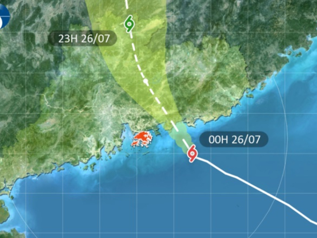
“Depending on the change in local wind conditions, the observatory will assess the need of issuing the Hurricane Signal, No 10. Tropical Cyclone Warning Signal, No 9 or above is expected to remain in force at least until 7 am today”, the observatory said in a statement.
The observatory last issued the T10 signal in September 2025, when the top warning was in force for 10 hours and 40 minutes during the passage of Super Typhoon Ragasa, which left more than 100 people injured in Hong Kong while toppling thousands of trees across the territory.
The HKO urged people not to venture outside and to stay away from exposed windows and doors.
The storm is forecast to make landfall somewhere between Huizhou and Shanwei, and pass around 100 kilometres northwest of the territory.
The HKO said Noul will bring frequent heavy squally showers and thunderstorms on Sunday, and urged people to pay attention to the latest weather information issued by the Observatory.
Wind gusts exceeding 100 kilometres per hour have been recorded on Cheung Chau, Green Island, Waglan Island and Tate’s Cairn.
As of 1am, authorities have received seven reports of fallen trees, while no injuries have been reported so far. More than 190 people have sought refuge at temporary shelters opened by the Home Affairs Department across the territory.
_____________________________
Last updated: 2026-07-26 HKT 01:46
Edited by Cecil Wong